Showing posts with label CANADA. Show all posts

Winter Climbs 2018: Camp 2 on Everest, Stalled Out on K2

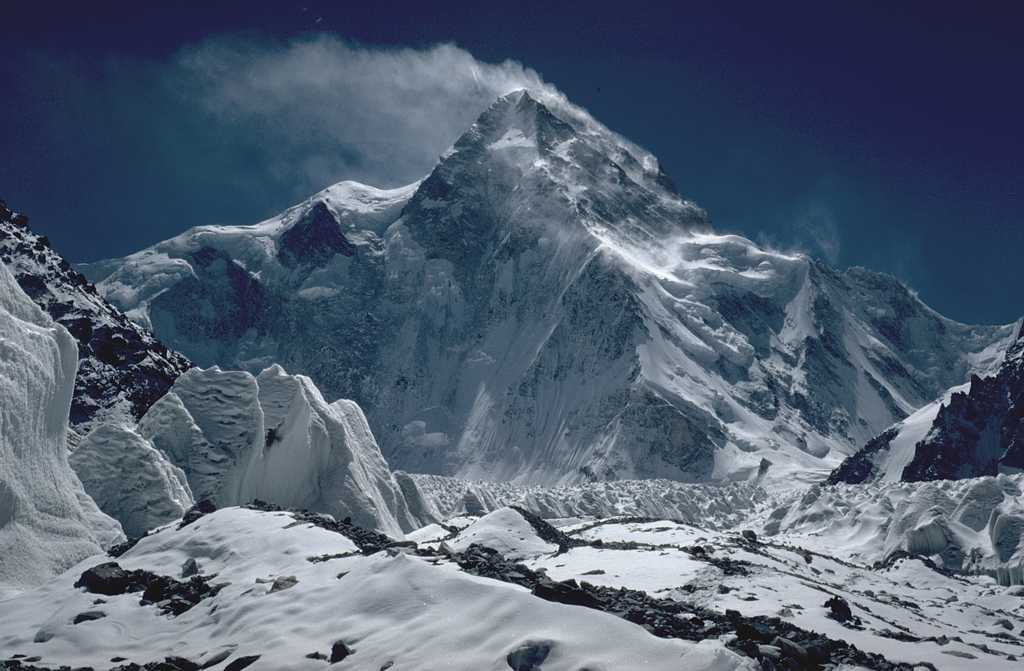
The major mountaineering expeditions that we're following this winter seem to have updates on an almost daily basis at the moment. That's a bit unusual considering the weather can often cause them to stall out for extended periods of time. But, there is news on several fronts with progress being made.

On K2, the Polish team reports that two of the members of the team have now gone up to 5900 meters (19,356 ft) and returned safely to Base Camp. Their jaunt up the mountain was meant to scout the route, and they discovered that there was little protection from the elements to be had in their intended spot for Camp 1, so instead they will set things up at 6200 meters (20,341 ft) instead.

The plan is to start shuttling gear to that spot in the coming days, but high winds are expected to hit the mountain soon, which will leave them tentbound in BC while they wait for things to improve. After that, they'll continue their acclimatization and gear shuttling efforts.

While the Poles sit and wait for the weather to improve, Alex Txikon continues to make good progress over on Everest. After spending the night at Camp 1 on Sunday, the following day he and one of the Sherpas made their first foray up to Camp 2 at 6500 meters (21,325 ft). Right now, the expedition is running well ahead of schedule, shaving off several days from the timetable that was used last year.

Alex, climbing partner Ali Sadpara, and the Sherpa support team have taken advantage of a good weather window to get plenty of work done on the mountain, including shuttling 600 meters of rope up to C2. They are currently back in Base Camp and resting up, with the Basque mountaineer reporting that high winds hit Everest while they were on their descent, so it could be a few days before they head back up again.


Finally, after a few delays due to poor weather conditions, Lonnie Dupre and Pascale Marceau should be ready to fly out to their starting point today. They've set their sights on Mt. Lucania, located in the St. Elias Range in a remote area of the Canadian Yukon. At 5240 meters (17,192 ft) in height, it is the third highest peak in Canada. What makes it so intriguing is the extreme cold they'll face on the way to the top.

High winds and cold temperatures kept the duo's flight grounded for the past few days, but conditions have improved enough to allow them to get started today. The'll be dropped off at a safe landing zone, then ski to the mountain, pulling sleds filled with gear behind them as they go. Those sleds will have about 100 pounds (45 kg) of supplies and gear to help get them through this expedition.

Stay tuned for more updates as the season continues to unfold.

Where Millennials Outnumber Baby Boomers


As a member of Generation X I increasingly find myself caught in the middle of a generational war between Millennials and Baby Boomers. It is a war that Millennials just might be beginning to win. The latest reports from the front-line suggest that the Millennials have now captured most large urban centers and are increasingly pushing Baby Boomers out into the wilderness, beyond the walls of

Adventurous Family Will Sail the Northwest Passage in 2018

One adventurous family has quite a journey scheduled for 2018. On June 1, Graeme and Janna Esarey, along with their daughters Talia and Savai, will set out from Seattle on a sailing expedition that will take them through the Canadian Arctic as they travel the Northwest Passage.

Graeme and Janna are experienced sailors who spent their honeymoon crossing the Pacific Ocean. They say that the plan has always been to sail with their children when it was age appropriate, and now they are ready to begin those adventures. The plan is to navigate through the Northwest Passage and continue on to Europe, making a journey that few have been fortunate enough to undertake until this century.

The fabled Northwest Passage was long sought by sailors and explorers looking to travel faster from the Atlantic and the Pacific. But due to thick ice and inhospitable conditions, it was closed for centuries. Modern ice breakers made it a more viable option, but the cost of operating those ships is prohibitively expensive. Now, climate change has made sailing the route a real option as it is typically completely navigable by August of each year.

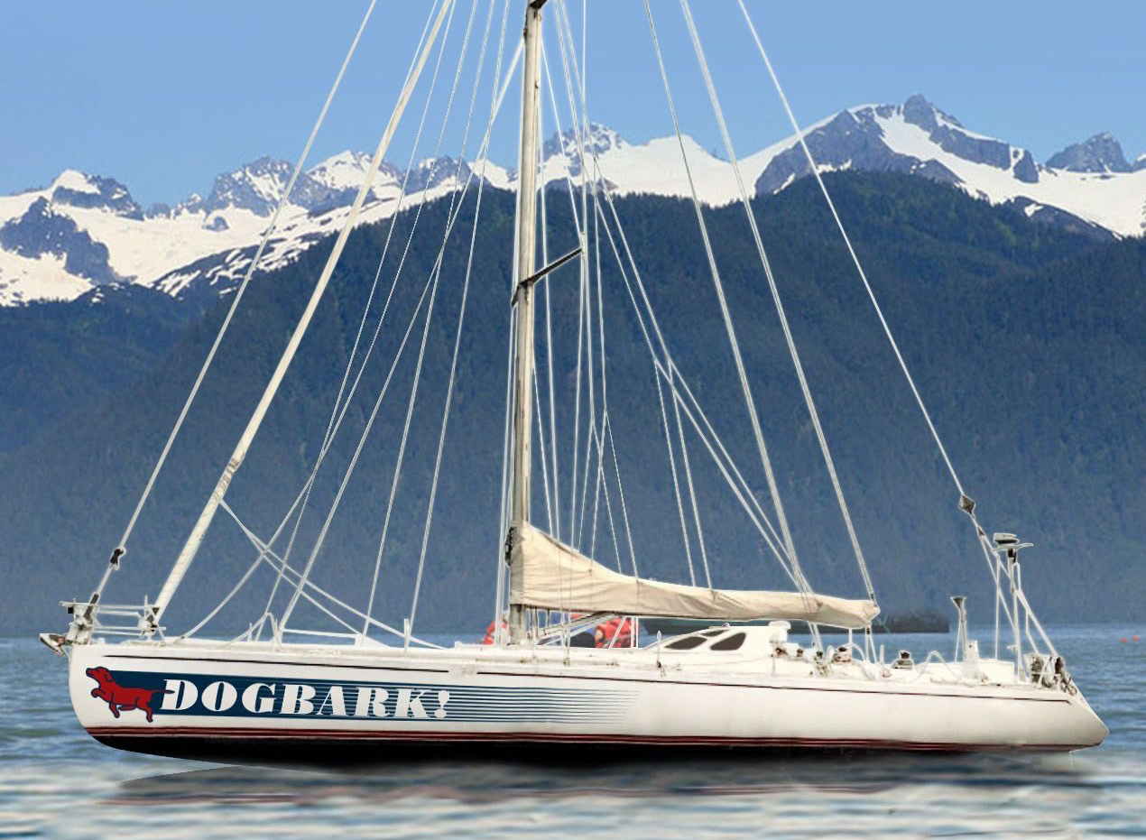
Graeme says the idea for making this sailing expedition came about after speaking to polar explorer Eric Larsen at Outdoor Retailer. The father of two has served as the CEO of gear manufacturer Industrial Revolution since 2011, and Larsen has been a brand ambassador for the company. After speaking to Eric, Graeme headed home with the germ of an idea for taking his family on a major adventure, which they'll undertake on a ship called the Dogbark – a 60-foot racing vessel with plenty of room to spread out, including separate cabins for each of the girls.

Currently the Esarey family is in planning and preparation mode prior to the start of the voyage in June. You can read all about their plans, and why they are undertaking this adventure, on their website saildogbark.com. The site is being updated regularly with blog posts about their progress and should be a great way to follow along with their journey once they embark in a few months.

Winter Climbs 2018: Txikon in EBC, Poles Trekking to K2

The winter climbing season on the big mountains is just getting underway and we'll be following some of the major expeditions very closely in the weeks ahead. Chief among them is the no-oxygen attempt on Everest by Alex Txikon and the attempt at a first winter ascent of K2 by the Polish team. While both expeditions are just now entering their early stages, we still have updates on progress.

Txikon has arrived in Base Camp on Everest after spending just 8 days trekking to the South Side in Nepal. The team arrived two days sooner than they did last year when the Basque climber made his first winter attempt on Everest, which was ended by poor weather conditions high on the mountain.

Alex, along with his climbing partner Muhammad Ali Sadpara of Pakistan, and their support crew are just now getting settled in BC, which they have established at 5300 meters (17,388 ft.). That's a bit higher than where they placed the camp last year, but the new spot provides more sunshine and warmth during the day and is located closer to the Khumbu Icefall, saving time and energy when shuttling gear up to the higher camps.

The team hopes to have camp established today and begin scouting their route through the icefall in the next few days. From there they'll start the acclimatization process by moving up the mountain as the weather permits.

Meanwhile, the Polish Ice Warriors team is now trekking to K2 to begin their attempt on that mountain. As the only 8000-meter peak that remains to be climbed in winter, K2 marks a major undertaking and the squad is eager to reach Base Camp and begin scouting potential routes. The launched their trek on December 29, and typically it takes about a week of tough hiking to reach the starting point of the climb. That means they should be arriving sometime in the next few days and hopefully we'll get regular updates on their progress after that.

Tomek Mackiewicz and Elisabeth Revol are already on Nanga Parbat, where they have started their acclimatization process. The duo haven't shared a lot of details from their expedition just yet, but they have now climbed above 6000 meters (19,685 ft.) as they begin to acclimate to the thinner, colder air. Tomek and Elisabeth arrived in BC last week and have slowly been assembling their camp and scouting the area. A part from a few support crew members in camp, they will be climbing in alpine style this winter.

Finally, Lonnie Dupre and his climbing partner Pascale Marceau have set their sights on a first winter ascent in the Canadian Yukon. They'll take a crack at the 5226-meter (17,146 ft.) Mount Lucania, which is seldom visited in the first place and has yet to be cracked during the winter months. They are expecting -50ºF/-45ºC temperatures, gale force winds, multi-day storms, and all of the other wonderful obstacles that come along with climbing in the winter. They will be getting underway shortly as well.

That's all for now. More updates as the season progresses.

150 Years of Mountain Photography


Between 1861 and 1958 land surveyors took thousands of photographs of Canadian mountains. These photos provide a wonderful resource of Canada's environmental history. A resource which scientists can use to observe how the environment has changed since the photos were taken.

The Mountain Legacy Project (MLP) has spent the last nine years working out where each of the original land surveyor

Video: Taking an Electric Mountain Bike for a Spin in the Backcountry

There was a point where I thought an electric mountain bike felt a bit like cheating. The extra pedal assist that they provide takes some of the challenge out of the ride. But, I've come to appreciate what an e-bike brings to the table, allowing more riders to enjoy the backcountry who might not normally get a chance to do so. In this video, we join pro rider Matt Hunter as he takes the new Specialized Turbo Levo Carbon for a spin through remote areas of British Columbia. As you'll see the bike performs well in this conditions. I was fortunate enough to get the chance to take this bike for a brief test ride a few weeks back, and came away very impressed. It is fun, fast, and efficient. I know what I'll be asking Santa for Christmas this year.

The Halifax Explosion


100 years ago tomorrow, on the morning of 6 December 1917, a French cargo ship carrying high explosives crashed into a Norwegian ship in Halifax Harbour in Canada. The resulting massive explosion killed 2,000 people in Halifax, injured at least 9000 more and destroyed every building within a 1.6 mile radius (over 12,000 in total).

CBC Canada has created an incredible 360 degree video which

Video: Taking on the Infamous Cobra Crack in Squamish

For crack climbers, the infamous Cobra Crack in Squamish, British Columbia is considered one of the most challenging climbs anywhere in the world. It is a nemesis that Mason Earle knows all too well, having spent a considerable amount of time trying to figure out his massive challenge. This past summer, he returned to Squamish to give it another go. Does he finally figure out what it takes to crack the Cobra? Watch the video below to find out.

Bike Thieves of Toronto


CBC Toronto has used data from Toronto police to map where bikes were stolen in Toronto from 2014 to 2016. The Toronto Bike Theft Map reveals that downtown Toronto experiences the most bike thefts but other neighborhoods, such as Willowdale West and Lansing-Westgate have also seen a rise in bikes being stolen since 2014.

The map includes a number of options which allow you to filter the map by

Power Plants of North America


The North American Power Plants interactive map shows the location of nearly 10,000 power plants in the USA, Canada & Mexico. The map also provides a breakdown of how much capacity is provided by each type of power plant. Currently natural gas provides over 40% of capacity in the whole of North America.

6,400 of the power plants on the map (generating one or more megawatts) use renewable

Toronto's Caffeine Gang Wars


Toronto's caffeine gang wars are tearing the city apart. As rival coffee gangs fight for territory local residents can do next to nothing to stop the relentless spread of caffeine. Innocent residents can only sit back and watch in horror as their neighborhoods are overrun by blank-eyed caffeine addicts.

Neoformix is more informed than most. They have been busy mapping the spread of coffee

Mapping Lonely Polar Bears


The Polar Bear Census is an interactive map showing the location of all the polar bears currently living in North American zoos. There are currently 70 different bears living in 33 zoos in North America. Using the interactive map you can learn about each of these polar bears, including information about their place of birth and if they have any brothers or sisters.

The map was created to

Mapping the Trans Mountain Pipeline


The Trans Mountain pipeline carries oil from Alberta to the west coast of British Columbia. A proposed second pipeline could increase the amount of oil carried from 300,000 barrels a day to 890,000. For B.C.'s coast this would mean more tanker traffic and the increased risk of oil spills.

The Globe and Mail has released a story map which explores What Kinder Morgan's Pipeline will Mean for B.C

THE FRENCH CONNECTION

OK, so I knew that the Canadians in Quebec province spoke French, but I didn't really expect them to be soooo French! Except for an innocent little roadside sign announcing "Quebec", I would hardly have noticed that I'd crossed to another province in this vast country.
Then I noticed a number of things (I'm not sure in what sequence!). Every gas station and corner store sold beer! (In Ontario province there were government liquor stores, spread rather thinly across the land). The large grocery stores had different names, and they sold certain different products. All road signs and shop signs were only in French. But perhaps more surprising to me, suddenly people couldn't understand a word I said! (some would tell me - in perfect English - that they don't speak English). I'd been singing praises about the friendliness and hospitality of the Canadians, but now this bunch in Quebec seemed rather rude. However, the longer I stayed in Quebec, the more that perception changed. If I tried to address people in the bit of feeble French which I knew, they would soften up and try their best to assist me. (Sometimes I found myself speaking Spanish rather than French - I suppose that is not surprising after spending so much time in Latin America).
Anyway, I was still following the St Lawrence (Saint Laurent) all the way East through Quebec. There was quite a bit of shipping traffic, but the larger container vessels didn't seem to go any further than Montreal.
Further east at Quebec city there was even a big cruise ship moored in the port. Another difference from some other provinces was that I couldn't cycle on the freeways (but there was always an alternate route, sometimes even a dedicated bike path). In Montreal I accidentally ended up on the freeway, but the patrol car which pulled me over was quite friendly, and simply escorted me to a road along which I could proceed.
Quebec runs along both banks of the St Lawrence, and understandably there are many connecting bridges.
There are a series of dams in the river, forming lakes such as Lac Saint Louis. There are a number of hydro-electric power plants, usually positioned at the dams.
There were many churches, and it seemed that just about every village centred around a large church with twin steeples.
As it turned out, the people of Quebec had no problem with me camping wherever I wished. They regularly directed me to go off and camp in the local town park.
At times the weather was wet and cold, but I generally seemed to find some sort of shelter. Once I camped under the verandah of a visitor info centre, and another time the only reasonable shelter I could find was the glass covering around the local village post boxes.
From Quebec I entered into New Brunswick provice, the only officially bilingual province of Canada. However, the further I moved SE, and away from Quebec, the less evident the French became. I had thought of going all the way to Halifax, but I changed my mind and from New Brunswick I headed towards the USA border and the State of Maine.
Daily distances cycled since entering Quebec have been:- Beauharnois 106 km; Montreal 109 km; Becancour 124 km; Saint Croix 89 km; Montmagny 118 km; Port Joli 61 km; Riviere Du Loup 61 km; Saint Honore 71 km; Degelis 73 km; Saint Leonard 72 km; Aroostook 69 km; Hartland 80 km; Nackawic 88 km; and Vanceboro (USA border) 86 km. The total distance cycled across Canada is 6 577 km, and the total distance cycled so far on this journey is 116 377 km.

ON IN ONTARIO

After staying with Colin in Toronto for more than a week I had to carry on moving again. My bike, Old Saartjie, had lots of new bits and pieces fitted, and was certainly in much healthier condition than when I arrived in the city.
Thanks to Colin for the stay at his home, for organizing the presentation which I did, for giving me some spare bike parts, for entertaining me and showing me around his home town, for fixing my computer, and for the cash he gave me when I left to see me on my way.
On the 3rd day after leaving Toronto I camped in the back garden of Jim and Joan (friends of Colin) in Kingston, Ontario. Jim had cycled the Tour D'Afrique with Colin 10 years ago, the bike was gathering dust in the shed, so he urged me to glean from it whatever I needed (thanks Jim, your bike lives on!). The two of them wasted no time in taking me out for dinner and breakfast, and leading me on a walking tour of their lakeside town on a beautiful Saturday morning. It was nearly mid-afternoon by the time I left their house, heading north-east through Ontario province down the St Lawrence river.
Without really thinking about it, I assumed that the Thousand Island salad dressing originated somewhere in the Carribean. Now I discovered that the "Thousand Islands" are in this part of the world, where the St Lawrence river flows out of Lake Ontario east towards Quebec. The river forms the boundary between Canada and the USA at this point, and there are a number of high bridges crossing the border.
Earlier, while in Toronto, I was interviewed on-line by Dave Briggs, and the interview is posted on his TRAVELPAGES (click on this link to see it).
Daily distances cycled since Toronto have been:- Port Hope 96 km; Bellville 112 km; Kingston 71 km; Lansdowne 47 km; and Long Sault 129 km. The distance I've cycled so far since entering Canada in the West is 5 369 km, and the total distance on this trip is 115 169 km.

THE GREAT LAKES

Now I'm back in Canada again, after the sojourn into the USA to the South of Lake Superior. On the Canadian side of Sault Saint Marie I spent the night in the biker's free camp site behind the Velorution bike shop.
Unfortunately it was Sunday, and the next day was a holiday, so I never met owner Andre. Also camping there were French Canadians David and family, cycling across Canada in the same direction as me. The other campers that night were Alex and Deanna. Again, the weather wasn't wonderful, but I successfully sheltered behind a church one night. On another occasion I could see the clouds building in the late afternoon (and they build rather fast), so I camped inside a dilapidated house. Well, after the repeated storms that night everything was soaked, as it turns out there was practically no roof anymore. To add insult to injury, the resident mice chewed a hole in my tent (probably after the smell of former food, as I didn't actually have anything to eat with me then).
As I was cycling through the small town of Thessalon, I suddenly heard somebody shouting a lot of things towards me, in AFRIKAANS. I spun around to see what THAT was all about, and there stood Dave Chamberlain, pushing a pram. He has run in various places around the world pushing his gear along in a baby stroller, now he is crossing Canada East to West. We had a good chat there in the middle of Canada, sharing experiences. (By the way, as I may have mentioned before, just about everybody in Canada seems to have a South African doctor - I wonder if there are any of them left in SA?).
I started to expect rain every night (even although it may not have seemed that way). At Webbwood village General Store I enquired about the possibility of a covered space to camp, and owner Bunny offered up the verandah of her house next door. For supper her and her sister gave me sandwiches from their store, coffee and more sandwiches for breakfast (as well as some cash to take care of my next meal).
I took the short cut (also to avoid traffic) across Manatoulin Island towards Toronto, which meant a ferry ride from the Island to the Bruce Peninsula on the mainland to the South. At the ferry dock I again ran into cyclists Alex and Deanna (who I'd met earlier). Alex was fishing off the dock with some rather light tackle when he hooked a huge rainbow trout (luckily another fisherman had a net with a long handle with which to haul up the fish).
And so, eventually I got into the outskirts of the sprawling city of Toronto. First I had to cycle through (cities in their own right) Brampton and Missisauga (see pic of "Marilyn Monroe Towers") - luckily it was Sunday and the traffic was not too heavy.
Colin had given good directions, and before dark I managed to find my way to his home not far from down-town in Toronto. I'd met Colin in 2005 after the Tour D'Afrique in which Leana had participated, and he stayed on in Cape Town at her place for a while (pity Leana isn't here as well).
So now I have an opportunity to shake my feathers right, and to take stock before I head off again. My bike, Old Saartjie, needs serious attention (I almost didn't make it to Toronto), so now I have some time to try and sort that out (thanks again to my sister, Olga, for the funds - and thanks also to prospective cyclist Peter for the donation). I've done my laundry, Shampoo'd and showered, and I've even shaven my face for the first time in a long time. Even Colin's cat, Tobias, seems happy with my presence. It seems likely that I'll stay here in Toronto until next week, as I may do a presentation of my trip on Monday night.
Daily distances cycled since I re-entered Canada at Sault Ste Marie have been:- Bruce Mines 57 km; Blind River 78 km; Webbwood 110 km; Manatoulin Island 109 km; Miller River (+2hr ferry) 59 km; Shelburne 165 km; and (eventually) Toronto 124 km. The total distance which I have cycled so far since first entering Canada about 7 weeks ago is 4 914 km. The total distance which I have cycled so far since the start of this journey in Cape Town is 114 714 km.

BACK IN THE USA

Since before my previous report from Winnipeg, I had been advised by various sources that the Trans Canada Highway through parts of Ontario Province was narrow, busy, and hilly. It would therefore be better for me to cycle across the border, back into the USA for the stretch Eastwards, South of Lake Superior.
There were various options regarding where I could cross the border, but the day I left Winnipeg the wind was from the North, so I went due South. I was kindly escorted to the city limits by my Warmshowers host Art, on his reclining bike.
Although my US visa is valid for 10 years. I still need to get an entry permit at the border, and I had one for 6 months when I came into Arizona from Mexico. Now I entered the USA again, even before the first permit had expired, but because I had handed that card in when I entered Canada, they gave (sold) me a new permit which is valid for another 6 months.
On the Southern side of the border I found myself in North Dakota state, and I kept going South for a while until I caught Hwy 2 East at Grand Forks. Things in the grocery store were cheaper than in Canada once again, although I didn't really have the money to splash out. I then cycled through the Northern Mid-Western state of Minnesota, there were a lot of farming communities and people were very friendly. On the outskirts of the small town of Deer River I had a puncture late in the afternoon with the threat of an approaching storm, I asked to camp at the nearest house, and Wade Wilson suggested I sleep in his caravan to escape the rain - he also fed me and gave me a bag of snacks for the road.
There are also many lakes and Indian Reservations in the area, such as Red Lake and Lake Leech communities. The legendary Missisipi river has it's source in this region, where it is just a small stream which I crossed a few times.
Apparently the most Western American port accessible from the Atlantic Ocean is Duluth, a city at the SW tip of Lake Superior. There I arrived in the rain at Warmshowers hosts Leah, husband Jeray, & hound dog Sasha. We had a good bratwurst dinner, my laundry went into the washer for the first time in a while, and the following morning Leah escorted me on the bike paths and back roads to the bridge where I could cross over from Minnesota to Wisconson state. It was still somewhat rainy, so I was not surprised to be the only cyclist on the bridge-bike-path that day.
It didn't take me too long in the rain to reach the small town of Poplar, Wisconson. There I stayed with another Warmshowers host! (sometimes I'll spend 2 weeks filthy dirty, camping in the bush, now I have 2 luxury accommodations in a row!). Scott Lundberg owns the local hardware store (as well as some other interests in the area). I had the run of his personal "den", which is built off the garage/workshop where I could spread out my stuff to dry. Scott's wife was away and he wasn't going to cook for me, so he took me out for the best prime rib I can remember eating (and of course we made a turn at the local bar afterwards). The following day the weather had not yet cleared, so I decided to stay and work on Old Saartjie in the workshop (constant attention to the bike is necessary at this stage). Well, of course I was taken out again that night, this time for a "river bottom" gourmet pizza! I realized that this was a close community when we bumped into the lady from the visitor centre in Superior city, where I had obtained a road map when I entered Wisconson. When I said goodbye to Scott the following morning at his hardware store, he went overboard and even gave me some money to see me on my way (and I'm extremely grateful - although I wasn't supposed to say anything about the luxury treatment either, as other cyclists may expect the same!).
There is also a lot of Finnish and Swedish heritage in that region. Many Northern-European settlers arrived there generations ago (I guess they were bred to deal with that kind of weather), and they are still somewhat proud of their heritage. Even in Minnesota, where I stayed with (German) Leah and Jeray, they still maintain their roots. In those few states (Minnesota/Wisconson/Michigan) there were more Lutheran churches than what I have previously seen in total).
Mostly the road didn't run flush alongside Lake Superior, but sometimes it did. I was lucky one day, when on leaving the town of Marquette it looked like rain again. The sky cleared and it turned out to be a beautiful afternoon. I found a nice secluded spot on the shore of Lake Superior, and set up an early camp. I could have a wash in the chilly waters of the largest fresh water lake, and also rinse out my cycling gear.
Lake Superior apparently has a big influence on the weather in the area. One afternoon in the Upper Peninsula of Michigan the sky suddenly darkened, and I quickly found shelter in the workshop of a logging camp (I'm particularly scared of the hail, which has nailed me a few times already). I chatted to the truck mechanic there while I waited, asking him about the weather prediction. He told me in simple terms:- "Welcome to the UP, if you want to know what the weather's gonna do, then wait 10 minutes". Well, I'm still a bit confused, because in the next hour it went from drizzle to hail to heavy showers, and just as suddenly the sun was shining again. During the worst of that storm I sheltered under the verandah of a church, and thinking that I may need to camp right there for the night I filled up with "holy water" from the gushing roof gutters (I needed it that night anyway, as I found a good spot to camp just down the road). On my last night in Michigan the sky looked threatening, and I saw a farmstead with a rather large barn. I headed down the drive, knocked on the door, and met Andy & Rhonda. I broke in their brand new horse barn (no horses inside yet), and they fed me a hearty egg-breakfast the following morning (fresh from the nest), and gave me a bag of boiled eggs for the road (my dinner that night).
My return to Canada was on a breezy day, at Sault Saint Marie. I'd cycled East through Minnesota on the Upper Peninsula North of Lake Michigan, and I'd reached the Eastern end of Lake Superior. Although the sign read "only motorized vehicles", for a toll fee of $1-50 I was allowed to access the rather long and narrow bridge. There was a gusting cross-wind on the bridge, and I had to stop a few times to let traffic pass. The bridge goes over the locks by which the ships can enter Lake Superior, but I had no time or space to take pictures of those interesting activities as I passed overhead. My Canadian visa is for a single entry only, but while it is still valid I'm allowed to cross the border to the USA and come back again - they just didn't stamp me "IN" again (pretend I've never left Canada, but that's OK with me).
Daily distances which I've cycled since my last report from Winnipeg have been:- Pembina (USA) 135 km; Drayton 64 km; Crookston 141 km; Bagley 101 km; Deer River 138 km; Floodwood 103 km; Duluth 74 km; Poplar 65 km; Hurley 143 km; Trout Creek 121 km; Michigamme 90 km; Shot Point 83 km; Seney 101 km; Brimley 127 km; and Sault Saint Marie (Cananda) 43 km. The total distance which I've cycled since first entering Canada is 4 212 km, and the total distance of this trip so far is 114 012 km.

THE SOUTH WEST

If you happen to be looking at the world map, then this region of Canada may seem more like the North West (but it is obviously the South West of Canada, where I have been cycling for the past couple of weeks.
Yes, this region is fairly flat (but not a snooker table). The roadside scenery consists mainly of prairy cattle fields and cultivated grain crops, and it is not too difficult for cycling. As I've mentioned in my previous post, the wind can help me, or it may be a serious hazard - depending on the direction. When I last did an update of this blog, I was at the home of Bonnie and Doug in Medicine Hat, Alberta. Subsequently they took me on a tour of the town (that's how I get to know more about these places), and the morning I left there with a full stomach and plenty of food for the road. For the next day or two the breeze was mostly in my favour, and I therefore made good time. Within three days I was at the home of the next Warmshowers host, Glenda, in Moose Jaw, Saskatchewan.
At the provincial border line Saskatchewan was labelled "naturally", so I took it seriously and camped up on a bird-watching platform that night. In the early hours the storm would have made me fly with the birds, but there was a solid railing to which I had tied the tent (luckily!). The road in this region seems to follow the busy Canadian Pacific Railway, and I've included a number of pics showing the railway, the fields, or both!
Due to some nice tail breezes, I arrived at Warmshowers host Glenda, in Moose Jaw town, a day early. There were 6 other (3 unrelated groups) cyclists and a support driver already there, but Glenda was not bothered by that. Ironically, the organization which had brought us all there is called "Wamshowers", and Glenda's water heater had just broken. Unphased, she marched us 1 by 1 down the road to her friends Joan and Pat, where we all had a warm shower (and a good chat). Incidently, their last name is "Murphy" - now I wonder if that had nothing to do with the broken geyser? In the 2 days that I stayed there, Glenda piled on the good food, some of it learned from her Mennonite heritage. Her husband Larry is an African American from the "Deep South", and Glenda jokes that she married him because she could be certain they weren't related! Although it was hard to leave there, I got back on the road with a flask of soup, home baked muffins, and a pack of lentils (which I have already used for a stew). In any case, a reporter from the local newspaper came out to interview me, and the next day I was on THE PAGES.
Heading East from Saskatchewan into Monitoba province, I found myself pedaling hard into the wind, and one day I decided by 1pm (50 km) that I'd had enough, and camped in a farmer's barn close to the roadside. My decision to call it a day had been hastened by the storm which I could clearly see heading my way, straight ahead. Well, luckily, by the time the storm broke I already had my camp set up in the mouth of the barn, but the way these storms go with the swirling gusts, it still managed to get some things wet! Earlier in the day I'd stopped at the visitor centre of Indian Head village to get some water and use the toilet (and the ladies looking after the place took my pic, I may also have made their local paper)! The following day the breeze was mostly up my ass, and late in the afternoon I decided that 230 km had been enough for one day, so I pulled into the small country town of Oak Lake to see what I could see. Suddenly I was hauled in by another cyclist, who traveling in the opposite direction and had obviously seen me pass. At first I assumed that he may be from East Asia, but as it turned out he was from Toronto. He pulled up alongside me, put his arm across my shoulders, and with his "smartphone" he snapped a pic of him and me - his new best friend. In a flash he was off in search of formal accommodation (without divulging his name or asking mine). I turned around and noticed retired farmers Marie and Bill Barron laboring in their impressive veg garden. I enquired about the usual (water and camp site), but before long my tent was pitched on their lawn, my clothes were in the washer, and I was under the shower. It got better from there, as I found myself propped up at the table with a cold beer in hand, and hearty farm food was presented. The following night it looked like rain again, I asked at a farm and Janet said OK I could camp on her horse's hay under a barn roof (yes it did rain, and hard!). John in particular was an armchair traveler dreaming of getting to faraway places, and I told him stories while I was happily chugging down his beer (quite aptly, his last name is Mc Entee - rather close to the famed Mc Ginty Irish pubs).
Well, it didn't take me all that long to get to Winnipeg (half way between Vancouver and Toronto), where I am staying tonight with Warmshowers hosts Art and Sue. They have stuffed me full of pizza, which was great as I haven't had that Western "delicacy" for some time now. I'm also using their internet to post this update.
Daily distances cycled since my last update from Medicine Hat have been:- Gull Lake 189 km; Morse 120 km; Moose Jaw 135 km; Indian Head 146 km; Wolseley 52 km; Oak Lake 230 km; Carberry 99 km; Oakville 124 km; and Winnipeg 60 km. The total distance cycled so far in one month in Canada is 2 683 km, and the total distance cycled so far on this trip is 112 483 km.