


Looking back at historical data from the Big Delta site, snowfall amounts stopped being reported with the introduction of the ASOS in 1997, but from 1941-1997 the latest measurable snow on record was May 22, 1995 (1.2 inches reported). Note the year: 1995, which was the year of the great May heatwave, as I noted in several recent posts. Is it a coincidence that late snowfall occurred about 10 days after extreme early heat in both 1995 and 2015? Not at all, I would argue: an amplified weather pattern lends itself to extremes in both directions.
The upper-level feature responsible for the cold and snow was a sharp trough with a small cut-off low embedded within it. Here's the 500 mb height analysis from Environment Canada, valid for 3am AKST yesterday; the intense high at the dateline over the Arctic Ocean is a key blocking feature, and the trough over interior Alaska is evident, with a closed low analyzed just below the "L" label.

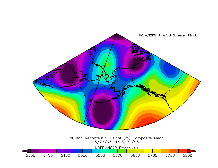
Now compare the 500 mb height analysis from May 22, 1995; the similarities are almost uncanny.
Here's a bit more detail on yesterday's 500 mb flow pattern, from a National Weather Service computer model forecast (maps valid for 3am and 9am AKST yesterday). The orange/red blob near Fairbanks is a patch of strong cyclonic vorticity (i.e. counter-clockwise swirl) associated with the small closed low.


Finally, lest there be any doubt regarding the existence of the cyclonic "swirl", here's a simple radar animation from the Fairbanks NEXRAD yesterday morning. The band of snow that affected Delta Junction becomes evident under the "Ft Greely" label.
