


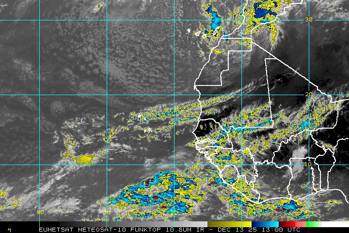
 On the image to the left, you can see three features on the Satellite picture.
 - Upper right is an area of disturbed weather-nothing to worry about.
- Over Africa, there is another good looking feature. Could be something to watch in a few days.
- Lower screen is T.D. 12. NHC is confident it will get stronger in the days ahead.

Long range models like the CMC, show a well organized cyclone in about 5-7 days northeast of the Leeward Islands. High pressure (Shown in orange) will push the system (shown as a small green circle) northwest .
By the middle of next week, it could be a category 2. You will notice by then the high weakens and opens a road for Katia to take. We are hoping it will remain an open water storm.
 The GFDL model also shows a good looking tight cyclone, northeast of the Leeward Islands in about 5 days.
 Here too, the model develops a gap in the high that "Katia" should move through and hopefully avoid all land areas.
Bermuda should keep their eyes out, just in case.
I'll be watching the progress of TD 12 tonight and tomorrow and see if it develops into Tropical Storm Katia.