


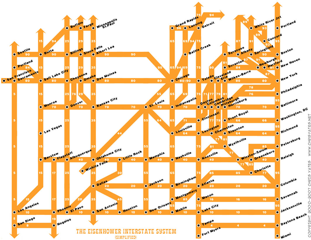
An interesting graphic which schematically portrays the interstate highway system. The image will be too small here in the blog; the original is easier to view and can be enlarged. It's not perfect, especially re Wisconsin, which appears to have been eliminated from the map; I43 and I39 are missing and I94 ends in Chicago without continuing to Madison and Mpls.
The graphic did remind me of something I had forgotten (or never learned). Everyone knows that even-numbered highways run east-west and odd-numbered ones run north-south. But I was surprised to note that the numbering system is also patterned with numbers increasing as one moves from south to north (10,20,40,70,80,90) and from west to east (5, 15, 25, 35... 95).
The schematic doesn't show the NAFTA superhighway, but that's another story... Those interested in conspiracy theory and corporate malfeasance might be interested in this link to a story about how the "highway lobby" systematically killed off passenger rail and urban commuter systems.